
The state's continuous stormy weather is swelling California's large snowpack to near record levels.
Combined with the series of winter storms that hit California in December and January, recent storms have given the state an above-average snowpack, officials said after the monthly survey on March 3.
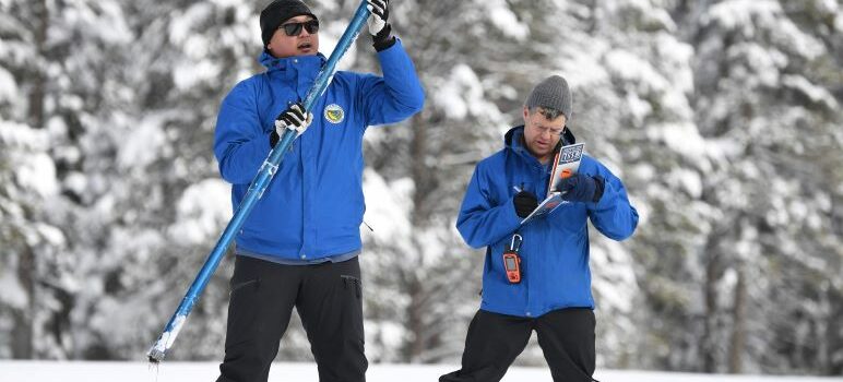
Results from the state's latest manual snow survey, conducted on Friday, recorded 116.5 inches of snow depth at the Sierra Nevada's Phillips Station, which is 177 percent of average for the area at this time of year.
The California Department of Water Resources' electronic snow sensors throughout the state detected that the snowpack's snow water equivalent is 44.7 inches, which is 190 percent of average for Friday.
“Thankfully the recent storms combined with the January atmospheric rivers have contributed to an above-average snowpack that will help fill some of the state's reservoirs and maximize groundwater recharge efforts,” DWR Director Karla Nemeth said. “But the benefits vary by region, and the Northern Sierra, home to the state's largest reservoir Lake Shasta, is lagging behind the rest of the Sierra,”
“It will also take more than one good year to begin recovery of the state's groundwater basins."
Water officials said that with one month left in the state's wet season, they are closely monitoring spring runoff scenarios to maximize state water supply and prevent flooding.
“The recent storms over the past week broke a month-long dry spell in a dramatic way,” said DWR's Snow Surveys and Water Supply Forecasting Unit Manager Sean de Guzman. “We are hopeful that we will see more cold storms to add to our snowpack for the next month and help set up a long, slow melt period into spring.”
The state’s next snow survey is tentatively scheduled for April 3.
Olivia Wynkoop is a reporter with Bay City News.