
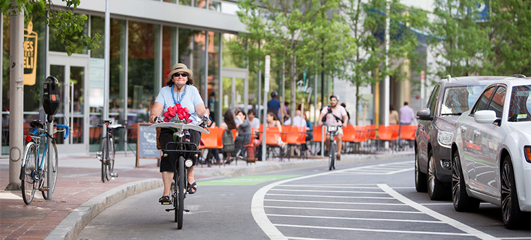
Though San Jose overall is the deadliest city in the South Bay for bicyclists, the most dangerous intersection in Santa Clara County lies about 20 miles north.
That’s according to a new report produced for law firm Walkup, Melodia, Kelly and Schoenberger by 1Point21 Interactive, which analyzed four years of bicycle crash data from the California Highway Patrol.
From 2014 to 2018, the county saw 3,745 bicycle collisions, which resulted in 3,520 injuries and 41 fatalities. By identifying clusters of three or more cycling-related injuries, analysts identified 361 “danger zones,” which they plotted out on an interactive map.
Surprisingly, the most unsafe zone on the map is in Palo Alto, a town of 60,000 people that’s widely recognized as bicycle-friendly. The study also found that the two worst cycling spots in Cupertino lie very close to the Apple campus on Infinite Loop.
Another key takeaway from the report is how so many of the riskiest places for cyclists happen on expressways and major arterials. According to the 1Point21 analysts, over half of the 25 most treacherous spots lie on or near a major thoroughfare.
Below are some of the most notable findings broken down by city.
San Jose
With 1,473 crashes, 1,428 injuries (77 of them severe) and 21 deaths from 2014 to 2018, San Jose is—hands down—the deadliest city in the South Bay for cyclists. It’s also one of the most dangerous cities in the country for that mode of transportation.
According to the 1Point21 analysis, San Jose—a city of more than a million people—is home to 11 of the 25 most perilous spots for cyclists in the county. Some of the riskiest places to bike surround San Jose State University in the heart of the city.
South Market and San Fernando streets is the second-most dangerous zone countywide, with 17 total crashes and as many injuries. The intersection by Plaza de Cesar Chavez and a few blocks away from the university is made up of wide roads that converge with downtown traffic, scooters, cyclists and pedestrians. The study notes that “confused motorists” likely contribute to the high incidence of crashes in the area.
Located just a block northwest of SJSU, the intersection of East Santa Clara and South Fourth streets ranks 10th on the list, with 11 crashes, nine injuries and one fatality in the four years studied. Analysts say the “general flow of accidents in this zone is interesting.”
“It seems to indicate that a high amount of bike traffic moves from Santa Clara Street to St. John Street a block north,” the report states. “It is worth noting that St. John Street is one of the city’s dedicated bike boulevards: roads that are shared by motorists and cyclists alike, with a reduced speed limit to accommodate the safety of cyclists.”
Coming in at No. 12 on the list of most precarious spots is East San Fernando and South Fourth streets, which sits just to the north of SJSU. Eleven crashes took place at the intersection, leading to nine injuries—two of which were critical.
Palo Alto
Certified by the League of American Bicyclists as a gold-level bicycle-friendly city, Palo Alto claims to have built the first bike boulevard in the United States and regularly markets itself as a destination for cycling enthusiasts.
But with 463 crashes, 438 injuries (15 of them severe) and one death from 2014 to 2018, Palo Alto’s statistics belie its reputation. According to 1Point21, five of the county’s 25 danger zones are located in Palo Alto.
Where Park Boulevard cuts across Page Mill Road, cyclists were involved in 17 total crashes that caused 15 injuries. The intersection, which lies in the Evergreen Park neighborhood, includes a road that connects to a major highway, where vehicles tend to travel at greater speeds when entering or exiting.
No. 15 on the list, with 10 crashes and 11 injuries, is Arastradero Road and Foothill Expressway. The intersection next to the Alta Mesa Memorial Park borders what analysts describe as “an incredibly wide arterial road” prone to crashes for cyclists.
Tied for No. 18 is the intersection at West El Camino Real and Stanford Avenue, where smaller bike-friendly roads link up to major thoroughfares. “This sudden transition may be a contributing factor in bicycle crashes,” the report states.
As for the most dangerous place to bike in the whole county? The study says it’s a few blocks away from downtown, where Waverley Street intersects with University Avenue. Over the four-year span analyzed, the intersection saw 49 bicycle crashes and 41 injuries. The second-chanciest zone in the study saw nearly a third fewer crashes and injuries.
Sunnyvale
One of the biggest South Bay cities next to San Jose is Sunnyvale, a town of more than 150,000 residents that claims the third-most bicycle crashes in the county. However, despite coming in third with 329 crashes, 308 injuries and six deaths, it’s home to just two of the top-25 danger zones.
The least safe place to ride through in Sunnyvale: East Evelyn and South Sunnyvale avenues, where 10 crashes took place that caused 11 injuries.
The intersection is close to a number of notable landmarks, including Plaza del Sol and the historic Murphy Avenue. Analysts suggest that a nearby train station may contribute to increased foot traffic and, therefore, a greater change of cycling collisions.
Mountain View
Google’s home turf came in fourth place on the hot-spot list.
Mountain View’s bike crashes over those same four years amounted 256, causing 231 injuries (11 severe) and two deaths. That’s in a town of more than 80,000 people.
Two of the top 25 danger zones in the county lie in Mountain View, which ranked fourth of all South Bay cities in terms of overall crashes.
North Rengstorff Avenue and Central Expressway saw 12 total crashes and 11 injuries, which analysts say might have owed to the wide intersection and nearby railroad tracks.
Santa Clara
Mission City’s crash total came to 207, leading to 191 injuries and one death.
Santa Clara—a town of 127,000—reported less than a seventh of the number of bike crashes as San Jose, but one of its two danger zones made it to the top-25 worst-in-the-county list. Namely, El Camino Real and Helen Avenue, which lies in Koreatown near the border of Sunnyvale, ranked eighth riskiest in the county because of nine crashes that led to one fatality and seven injuries.
“That could possibly be explained by the lack of traffic signals at a pedestrian crossing of a major road where the speed limit is 40mph,” the report states. “The addition of a new pedestrian crossing indicator at this crosswalk may curb collisions, but we suspect further modifications must be done in order to reduce crashes here at a significant level.”
Vision Zero
Though several South Bay cities have taken the Vision Zero pledge—a global initiative to eliminate traffic deaths—progress has been slow.
Colin Heyne, a spokesman for the San Jose Department of Transportation, said the study overlaps with some of the city’s findings about where the riskiest intersections lie.
Thankfully, he added, the city is working on improving street safety in the wake of a historically bad year for pedestrians and cyclists. “Out of 60 fatalities, 29 were people walking,” he said. “That is disproportionately high considering how many trips are taken by foot in our city, as well as when compared to national figures.”
Earlier this year, the City Council budgeted $6.7 million to make streets safer for people traveling without cars by funding so-called quick-build projects such as plastic barriers.
Brandon Alvarado, who chairs San Jose’s Bicycle and Pedestrian Safety Advisory Committee, says he hopes the data doesn’t discourage people from biking.
“My obsession is getting more people to ride bicycles at a large scale,” he said, “and trying to figure out how we—as a city, as a company, as a university—get more people to enter into the sport, into the commute and basically just make it easier for them to ride.”
Though the statistics seem daunting, Alvarado said they could be a useful guide for cyclists trying to steer clear of the riskiest roadways.
They also underscore the importance of education, he added. As a certified bike instructor, he said he often steers people toward training programs offered through the League of American Bicyclists. He advised people who are interested in signing up for the curriculum to search for classes on the league’s website.
> Surprisingly, the most unsafe zone on the map is in Palo Alto, a town of 60,000 people that’s widely recognized as bicycle-friendly.
Karma.
According to 1Point21, five of the county’s 25 danger zones are located in Palo Alto.Where Park Boulevard cuts across Page Mill Road, cyclists were involved in 17 total crashes that caused 15 injuries. I once had a close call at this blind intersection. No worries now though. A red light has been installed. No longer a danger of fast traffic on Park Blvd.
No. 15 on the list, with 10 crashes and 11 injuries, is Arastradero Road and Foothill Expressway. I cross here a couple of times a month. It is a large and complex intersection next to Gunn High School. One reason for a large number of accidents is all the students there.
Tied for No. 18 is the intersection at West El Camino Real and Stanford Avenue, where smaller bike-friendly roads link up to major thoroughfares. I cross here 2-3 times a week. It’s at the corner of Stanford University so there are many bikers there.
As for the most dangerous place to bike in the whole county? The study says it’s a few blocks away from downtown, where Waverley Street intersects with University Avenue. I think they are referring to the entire PA downtown region. It is very crowded there and there is no space for bike lanes, but the traffic in that area is fairly slow. I think it is the most dangerous place simply because their accompanying map highlights a fairly large area.
Hmmm!
I’d like to see a study of bicyclist and pedestrians in this area doing stupid things like running red lights and getting run over, riding in the wrong direction, walking in front of cars with their head stuck in cell phone that is stuck in their ass, not that bay area driver are any better than there bypedal counter parts.
As far as I can tell, this report does not normalize by the total number of cyclists or vehicles in each area. It may very well be that Palo Alto has more bicycle collisions because it has many more cyclists. If Palo Alto has 5x the number of cyclists but only 2x the number of collisions as another area, we’d probably consider it safer. Without normalization, this report does not seem very useful and leads me to question the agenda behind the whole endeavor.